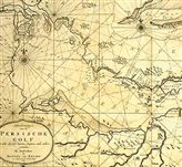


Persian Gulf Topography
Persian Gulf region is dividable into several major areas topographically. Very high, high units, hills and high grounds, low-height and low units are placed in this division. Dispersion of high and very high units is mainly in limits of Islamic Republic of Iran country division and has overwhelmed all of this country with northwest-northeast and also northwest-south and southeast trends. A highest point of Persian Gulf which is more than 5,000 meters high in some places is located in this topographic unit. High unit located in south of Iran is placed parallel and along Persian Gulf.
This unit is dragged near waters of Persian Gulf in some places and in addition to coast, heights and reliefs have been also cause of bed of Persian Gulf. Amongst other high regions, are small but significant areas of north and northeast of Iraq. This high unit which is continuation of Alborz and Zagros Mountains has numerous is succeeded by numerous advantages for this country hydro climatologically. In south of waters of Persian Gulf no considerable high units can be seen. Only in west and southwest of Saudi Arabia high strips with northwest-southeast trend have been brought into existence that Hejaz and Asir mountains form this region. Except for three above-mentioned areas, other parts of region are in form of hills and high grounds and low and low-high regions.