


Mokran Sea
Gulf of Oman
Writer: Rozbeh Parsapoor
Translated by: Yasaman Gholami
All about Mokran
Makran is the name of the area with original Aryan people in southeast of Iran, which has valiant and warrior ethnic groups with more than 3000-year antiquities. From the language and race view point during the history, Baluches constitutes the main part of Iran. Ferdowsi called the Baluches as a part of Keykhosro’s army, king of Iran. Furthermore, the name of Baluchistan is written, “Maka” or “Makran” in the inscription of great Darius on Bisotun and Persepolis, and it is named as a fourteen provinces of Achaemenian domination. (Six century before Christ (BC)). The name of Makran is written in numerous historical documents, and it is mentioned as a historic and ancient area. The coast of this country was called Mokran Sea those days. After Arabs' raid to the Middle East and east of Europe because of developing Islam, different areas were changed to the Arab name by them that these changes have no historic, ethnic and actual background because the base of the name of rivers and seas is based on ethnic, national and historical context of each area and its people. Nowadays, this sea is registered as “Oman” (Arabian Sea) in United Nations. But the country like Oman which was a part of Iran for more than 2200 years (in Achaemenian, Arsacial, Sasanian, Safavids and Zand governance…) and its people talked in Persian and constituted an inseparable part of Iran’s history, how can it be possible to name a south sea of Iran with a name of the small country of that side of the sea? Some of the inscription and historic documents of Makran are as follows:
10th paragraph- from the universal Bisotun inscription / Darius Achaemenian king stated: that Vahyazdata who named himself Bardia (son of Cyrus the great) sent army to Arachosia (sistan). Against a Persian named Van my servant, the satrap of Arachosia, He appointed a certain man to be their leader… Darius stated after battling with false Bardia, I failed all the liars and rebellious and became the ruler of Arachosia.
Inscription of great Darius in Naqsh-e Rustam/ These are the countries which are subject unto me, and by the grace of Ahuramazda, I became king of them, except Pars. I am their king and Whatsoever commands have been laid on them by me, have been performed by them, and I hold this empire: Mede, Khoozestan, Parthia, Herat, Balkh, Sogdiana, Khwarezm, Zaranj, Arachosia, Sattagydia, Gandara, India, Homenush Scythian, Tizkhood Scythian, Babylon, Assyria, Arabia, Egypt, Armenia, Cappadocia, Sardis, Greece, beyond sea Scythian, Macedonia, Greeks on the shield, Libya, Abyssinia (Ethiopian), Mac’s inhabitants, Caraians.
Abolfada wrote/ Ebn-e-Hoghl said: Makran is a vast and wide area. Mostly covered by deserts and inhabitants are involving with famine and difficulty. Tiz is a port in Mokran Sea, in the west side of the river of Mehrann and near a Gulf of Mehran river, which reaches to the Mansoor.
It is written in “Al-bab” that Makran is a city of Kerman province, between Tiz and Bedhe, and it is almost 15 zones.( Al-baldan calendar, p 397). People of Makran speak Persian and Makranian, and their merchants wore turban and cassock. Makran is a big region but most of it is desert. (The religious and cities, p 151), Hamdolah Mostoofi wrote: Makran is a big country with the second type climate and with 12 cities, its capital is Fazanboor. The weather is hot. Its water supply is the river, and two biggest cities are Max and Bashqrood with seventh type of climate and so many desert and regions. Most of its inhabitants are nomads. It is the name of a city in Iran and the name of a province as well. They call it both Makran or Mokran.(Borhan)(Anandraj). It is the name of a province with second type of climate between Kerman and Sistan, which was named after Mokran-ebn-Hital. Its main city was Caje, and they called it Kinhaj too. The name of state from Baluchistan beside the Oman Sea and the name of the city as well (Nazem-Al-Taba). It is an area near to Send, and the king of Makran lives in the Caje city. Kiz, Kooshkqand, Derek and Oscof are the cities of this country. (Hodod-al-alam). It is a very large area consisted of many cities and villages. Its product is sugar and exported everywhere. The border of the country from west reaches to Kerman and to the Sistan from the north and to the sea from the south (Moajem-al-Baladan). Makaran is a very large region out of Iran, which will be described in the end of article, but because it is inside the Kerman province, and it pays tax to Iran, I felt it is necessary to mention it here.(Nezhatal Gholob, Leaden p 141). Makran is a big country with the second type of climate, with 12 cities. Its capital is Fazanboor. Its territory begins from Khaledate Island from west and from north in ends to the equator. The weather is hot. The water supply is the river, and its major cities are: Tiz, Mansoor, Fahlfahre. It has a lot of farms and many houses and a lot of villages. From the north, makran reaches to Saravan and Bampoor, from south to Oman, from east it reaches to Kolat and from the west to the Booshagerd. The most important part of this is in the Shore of Oman Sea. It is, in fact, a beach plain with some dried rivers, indeed, because of the sands of the beach; the water of river goes to the sea from under the sands. The flowing water from the mountain of Bam is running to the south and make a lot of rivers such as: Dashtyari,Vahil,Rabij,Sadvij and so on. These rivers are dried during the summer but in the rainy seasons they overflow. The most important river between these rivers is Rabjit. The most important village of Makran are: Geh, Bent, Quaser, Qand, Bahookolat (the universal political geography, Page 261 -262).
(Nezhat-al-Gholoob, Liden, page 262) nowadays, makran is in the south east of Iran and near the frontier with Pakistan, this area is from the end of central mountains and deserts of east of Iran's plateau and consisted of mountains of Bashagerd and Begirband which from west to east end of the sea shore, and some territories near the frontier are a part of Makran. Some parts of Makran which was a region of Iran became a part of a new country named Pakistan, after the plots of colonial of England. The southern sea of Oman was named Mokran in the past, the same name of its northern lands.
Makran's weather is hot and in most of this region, Baluch nomads are living and because of that they named it as Baluchestan. ( Moin Persian dictionary, volume 6, page 2010) Also Fraidoon Jonaidi wrote about the Makran according to Shahname: the country of Makran is a part of Asia in the north of China and probably Korea is in the remainder parts of it. This country in the ancient time paid its tax to Tooran. In the story of Siavash in the mission of Piran, we saw that they send him to some countries to collect the taxes and one of these countries was Makran.
When Afrasiab defeated by King Keykhosro, he wrote a letter to the king of Makran and asked him to send foods and forage and permission to pass their territory, but the king of Makran refused that demands.
Except the islands of Pacific Ocean, Korea is the first country in which sun rises. We will talk more about that in a book named “Story of Iran, Based on Iranian’s quotes” which will be published later.
The Indian’s king gave domination of Deibel and Makran to Bahram. Bahram came back victorious and rich. Since then Deible and Makran are dependences of Kerman, because the Indian king gave the domination of this provinces to Bahram. (Farsname, By Ebn-e-Balkhi, page 82). The king of India gave Kerman, Omal, Tiz and Makran to him. (Farsname, By Ebn-e-Balkhi). For more information, the next two chapters of Turkish dictionary should be read. One of the documents about importance of Maran is Pahlavi texts from the Sassanid era. In the chapter of “cities of Iran, in Sassanid era” they mentioned shortly to Sistan, but in the chapter of “The amazement of Sistan” the Sassanid historian wrote:
The amazement and value of Sistan are more than the other cities of the country. Because the Hirmand river, Farzdan sea and Kiansce sea, mountains of Oshadashtar are in Sistan and also because this region is the homeland of Hoshidar and Hoshidarmah and Soashyant, the promised savior of Zoroaster religion will appear in this region.( the Pahlavi text, Saeid Nafisi, page 70).
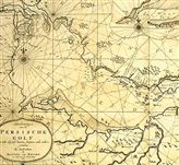
All about Mokran sea
Mokran Sea (Oman sea) is located in southeast of Iran which, in fact, is the continuation of Indian Ocean. It is limited to Iran’s coast from north and to Arabia Sea and Oman from south. Tropic cancer is passing from the south of this sea. Its width is about 320 kilometers from the Cape in northeast of Oman to Goatr port in the farthest point of southeast of Iran (Iran- Pakistan frontier), and its length is about 560 kilometers. It is connected to Persian Gulf from the Strait of Hormuz in northwest and from Musandam peninsula in the north. Ports of Mokran Sea (in coast of Oman) are Soor, Mosghet, Matrah, Khabota and Sohar in south. Qeshm and Hormuz Island in its northwest, in entrance of Persian Gulf, and Bandar-Abbas in the coast of Iran is also located in 14 kilometers of northwest of Hormuz Island. In past, Mazvan( Persian name of Oman) was located in its south coast that its center was Sohar and apparently its new inhibitions were ethnic groups of Iranians and not Arabs. It was popular for a while in Mazvan to have believers to Jesus Christ and bishop. It also was environed of Iran for a while and the sect of these people was Zaroastrian and in time of Arabs' raid had independence government.( Masoodi, first volume, page 177; Markoart, page 43-44). The name of Mokran Sea (Oman) is not exactly clear before Islam. Since it is a continuation of Indian Ocean, it has experienced various names. In some maps, which is belonged to before Islam, this area is cited as Aritre sea. There are about 10 ancient maps from Greeks, which named the Mokran Sea and Persian Gulf together as the Pars Sea. But after Arabs raid to Iran, and because Iranian have lost their previous political powers, many changes have been made in geographical names of Iran’s Sea( such as: pars to Fars; Ardeshirkhor to Firoz Abad; Azargashsb to Takhtesoleyman; Parse to Persepolise; Pasargad to Madaresoleyman; Abskon sea to Khazar sea, Arvand river to Shat-al-arab;Atorpatgan to Azarbaeejan; Pars Sea to Persian gulf and …). So the name of Mokran sea which is taken from Baluchestan and ancient culture of Iran was changed to Oman Sea of commercial market. Because of being devastated of ancient ports of Iran after raiding Arabs and substitution of ports, this sea was named Oman. Prosperity of Oman markets instead of ports and ancient markets of Iran is the important reason of fading the name of Mokran and being omitted from historical books. However, given the fact that the most coast of this sea is located in Iran and great civilization such as Shahr-e SoKhte, and Jiroft, which were from second millenary B.C and located here, so it is worthy to get its real name “Mokran” and writers and researchers should use this historic name in reply to Arabs' nonsense talking about south of Persian Gulf. This civilization is certainly one of the most affective urbanism civilizations of the world which evolved a world one day. The name of Oman is just a commercial name after raiding a country to another country, and it is not historic beauty and civilization.
Quoted Haradoat, in 512 B.C, for the first-time navy of great Darius with admiral of Greek Skilas entered the Aritre sea ( the red sea, Oman and Persian Gulf from Send river and visited the Mokran and Arabia coast( Oman).( Saykes, first volume, page 220; Pirnia, first volume, page 629, 631). In fourth-century AH, Oman sea was a part of Grand sea and each part of it was called with a name of a city beside it, like Pars sea, Basra sea and Oman sea ( Hodod-al-Alam, page 12, 164). Apparently, because of business boom of port and Oman city in Islamic era, Oman sea became important as well; because in that era, Oman city and port were considered as a gate for universal transportation and had a continual connection with Tiz port. Its merchants were the richest trades' people in cities and there were ships from west, east, north and south. (Haman, page 168). Green sea or Green Gulf which is somehow called Arabian Sea was located in its south (Bakran, page 22). In the past, Makran sea and Pars sea was the same and the coast of southeast of Iran was called Makran and Kerman sea. Kerman Sea (from east) was attached to the Makran Sea, and from west was ahead of Kish Island and covers some parts of Pars Sea. Makram Sea was attached to the Send Sea and Kerman Sea from west (Haman, page 21-20). Transportation gate of Kerman (in Kerman sea), Hormuz and gate of Makran( in Makran sea) was Tiz port. It can be understood from the issues of Afzaloodin Kermani’s book (before Moghol raid) that in that era, Tiz port, gate of Makran, was considered as intercontinental port of Affrica. It has trade relations with Egypt, Ethiopia and Zanj( Zang bar) and in central Asia with India and Send and in the middle east with Arabian countries such as Oman and Peninsula. In this era sugar cube is exported from Makran and Tiz, compound perfume, scarlet and other products are vended.
Sea’s of Iran’s southern shores, because of the vast region of Makran, is called Mokran and Kerman sea in coasts of Cha-Behar, Jask, Minab, Bandar-Abbas, Baluchistan and Pakistan. The distance of ports and Iran’s shore of Mokran( Oman ) sea from east to west are as follows: from Goatr port to Cha-Behar is about 90 kilometers. Tiz port is located in 15 kilometers of north of Cha-Behar port and Konarak port in 65 kilometers of west of Cha-Behar port is located in west border of Cha-Behar Gulf. From Cha-Behar to Jask port is about 290 kilometers: It is about 50 kilometers from Jask port to mountain Cape; from top of the mountain, which is about 145 kilometers. Minab river is about 145 kilometers. Minab river (Khoritab), as Greek historians narrated: Nearkhos, commander of Alexander, about 300 years ago landed and went to the Alexander’s camp in Iran, is the same with Anamis river. (Gabriel, page 31; Mostoofi, page 46-52-53). Distance of Minab city to Persian Gulf (Bandar-Abbas) from the main road is about 104 kilometers. In this distance, desert of Minab is located, which is the last part of Iranian’s shore in the coast of Makran( grand Islamic encyclopedia).
Because Mokran sea is a part of Conjoin road and Persian Gulf and its oil-bearing area with Indian Ocean, far east, eastern Africa, Mediterranean and Europe, it is imported economically and strategically and according to oil law, approved in August of 1957, continental shelf of Iran in Mokran sea, like Persian Gulf was objected to the provisions of oil law of Iran. Company of Iran’s fishery in north shores of Oman Sea has facilities. Because of clinging of an archeologist in the height of less than 200 meters, in northwest of the peninsula of Kenarak and river shores in south of Sadayech village (about 100 kilometers of northeast of Jask) and in 10 kilometers of southeast of Koohestanak village (about 48 kilometers of south of Minab), some pre-history antiques are found. These antiques are belonged to 500 years B.C in Sadayech and in Kenarak, they are belonged to ancient middle stone age. (Vitafinziand Kop land, page 149-50)